|
June
12, 1983 Sunday (1680.6 mtg) From
Gonzo!s Appalachian Trail journal
Broke
camp this morning and headed off figuring on camping again tonight
after about 18.4 miles. Sometimes the spacing of the shelters does
not give much of a choice as to where to stay. It is either a short
day, or an extremely long day, or camp. The distance to the next
shelter was just over 14.6 miles. For the typical hiker, that would
have been a good average day. But for me, a man with a mission to
get to Katahdin before it snowed, it was not far enough to go for
this day. Especially after coming off of a short day the day before.
We took a break after about six miles, and then began to pass through
a pasture that seemed like private property. We eventually passed
within a few yards of a rural residence and began a long switchback
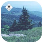
up the side of Beech Mountain. Nearing the top the forest became
more of an overgrown field and finally a bald-like area with a large
rock outcrop known as Buzzard Rock that provided great views to
the south and west. In the Whitetop mountain area just beyond Buzzard
Rock, I remembered having gotten a little mixed up when making my
way through this section in '81. We paid special attention this
time and still got a little mixed up as the trail turned off of
a gravel road and entered a wooded area. The marking could have
been more pronounced. Took lunch at Deep Gap Shelter after 14.6
miles. Met many hikers today. Several were at the shelter and seemed
to be staying. We were getting close to Grayson Highlands State
Park and Mt. Rogers Recreation Area and began encountering weekend
use of these areas. Pushed on after lunch expecting to camp in about
six or seven miles. I located and photographed a scenic spot just
before rhododendron Gap that I had been impressed with the last
time I was through the area. Looking back now, it is still very
nice, but I guess it just reminds me of a Hotel art scene now with
its picturesque open country bisected by a rustic old fence row
descending down the hillside. From there we continued to Rhododendron
Gap. A little less than two miles later we crossed the rail fence
into what is known as Grayson Highlands State Park, a nice open
area where one can occasionally catch views of the wild horses that
inhabit the area. The trail took us over open balds, some with a
few trees, and a lot of exposed rocks. It was a beautiful area.
A few miles after that we crossed Quebec Branch, where we had intended
to make camp, but decided that this was not the place to camp. This
meant today would be a big mile day. The next shelter was Old Orchard
Shelter. The time was already six o'clock, and we had 6.6 miles
to go! We must have been clipping off three miles per hour to make
the shelter at 8 pm. Just before arriving, I was beginning to wonder
if we would even make it there before dark. We hurriedly whipped
up a batch of Mac and Cheese, and butterscotch pudding for supper
and immediately went to bed. Later a couple other hikers arrived
at the shelter by flashlight, but decided to camp farther down the
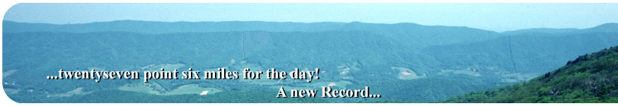
way rather than fully wake everyone up. Twenty-seven point six
miles for the day! A new record for us!
Gonzo!
Appalachian Trail Journals ©1983
|